Comments on the draft report were requested regarding the cause of the accident. Master B first recognized ship A near the northeast end of the wharf at approximately 7:07 p.m., where it appeared to be heading for the wharf.

Injuries to Persons
After confirming that no ships were sailing north of the Rainbow Bridge, Master B shifted his attention to the direction of Ship B's sail. He then noticed that Ship A was parallel to the Skete and appeared to be stationary, so he guessed that Ship A was in the process of docking at Skete and turned his attention to the direction of sailing.
Damage to Vessels
When increasing the speed of the main engine, vessel B rolled over vessel A's starboard bow, moved to vessel A's starboard side, and contacted vessel A's starboard plating, sustaining fractures and other damage to her mast. After Vessel A passed the accident site, Master B put Vessel B's main engine in neutral, and at about 19:28, he used the AIS vessel information application on his smartphone to check the name and nationality of Vessel A, which continued. navigate at that time.

Crew Information
According to the statement of officer A1, he joined company A2 around 2016 and after working as an officer on a passenger and cargo boat, he started serving as an officer on ship A from about July 2018. According to the statement of master B. from 2007 to 2010, he worked on a patrol boat in Keihin Port, then joined Company B and started working on a tug boat from about 2015. According to the statements of Master A, Officer A1 and Master B, at the time of accident, their state of health was good .
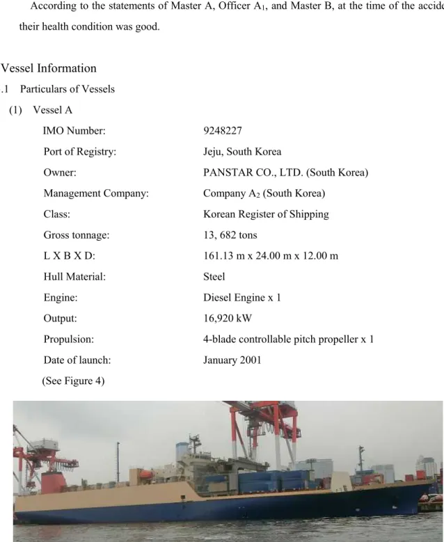
Vessel Information
① Vessel A had a control station in the middle of the bridge with radar No. 1, radar No. 2 and other navigation instruments on the starboard side, and the main engine and other control panels on the port side. ② According to the VDR record of vessel A, at the time of departure on the day of the accident, radar No. 1 was set to 0.75 nautical mile (M) range with STC5 of 30. 6 "Off-center" refers to the movement of the ship's position (a central light point) on the radar display and it is used to extend the forward detection range (direction of navigation) when the ship's position is opposite (astern) from the direction of navigation.
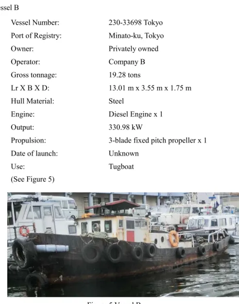
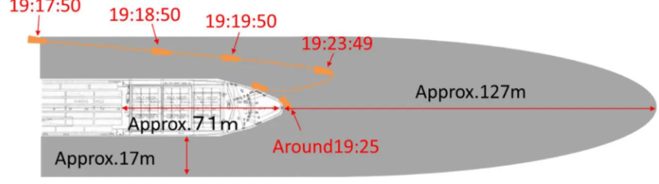
Vessel B had a steering wheel in the center of the wheelhouse, a GPS receiver on the port side, a main engine clutch lever, a control stick and a main engine speed indicator, etc. According to the statements of Master A and Master B, at the time of the accident there were no defects or damage to the hull, engines or other parts of the equipment on Vessel A and Vessel B. On Vessel A there was a blind area extending approximately 198 m forward of the bridge vessel , based on the sea level visibility of the officer of the watch on the bridge standing front center.
Furthermore, with observations made from the center of the wheelhouse to the vessel's side GPS receiver.
Weather and Sea Conditions
② Master B stood in the wheelhouse with his head protruding through the opening in the ceiling of the room from the time of departure, as he wanted to observe the surroundings thoroughly, but as he had to constantly wipe his rain-soaked face with a towel while keeping a lookout, it was difficult to assess the situation in his surroundings. ③ Master B kept a lookout while sitting on a chair after vessel B started navigating near Oi Container Wharf. According to the information from the National Astronomical Observatory of Japan, the sunset time was around 18:56 and the end of twilight was around 19:26 in Tokyo on June 10, 2019.
According to tide tables and charts published by the Japan Coast Guard, the tide at Keihin Port at the time of the accident was in the middle of a rising tide, with a height of about 99 cm. 6 in Tokyo Section 2 at Keihin Port was flowing northwest at about 1.0 kn and the water depth at the location was about 15.0 m. According to Master A's statement, around 19:00 the weather was rainy, the wind blew from the northeast with a wind of 4 and although the visibility was about 4 km, the heavy rain temporarily blocked the visibility in some places. .
According to Master B's statement, the rainfall was heavy and showed no sign of abating, so although he could recognize Vessel A near the wharf, visibility was poor and the sound of the rainfall was loud.
Information on the Navigation of Vessel A and Vessel B
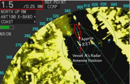
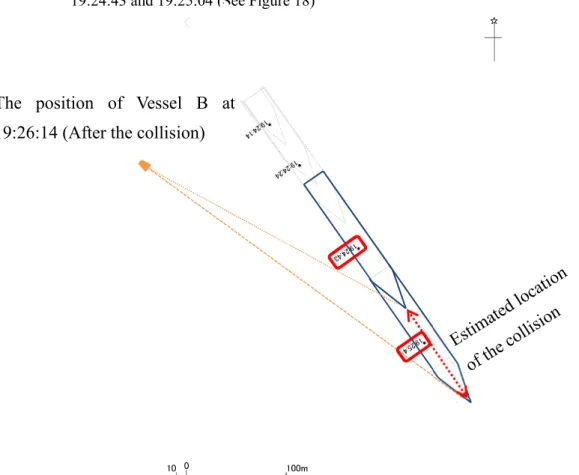
See attached figure 2 Radar images of ship A (excerpt)). 2) The estimated position of ship B and the distance between ship A and ship B based on the position information and the radar images of the GPS of ship A are shown in Table 3. The position information of the radar antenna above the bridge is mounted as follows: 75 m from the bow, 86 m from the stern, 12 m from the port side and 12 m from the starboard side. At approximately 19:26:14 the distance between the two ships increased and Ship B became visible again approximately 695 m to the starboard side of Ship A's radar antenna.
A based on AIS data and the estimated tracks of ship B are shown in Figure 14. According to the video recording of the SOLAS8 monitor installed at the Aomi Container Pier, Ship B was sailing near the port end of the ship. The distance from the bow of ship A to ship B is determined as the distance in the sailing direction because the course of ship A and ship B were almost identical.
Based on the distance and time from vessel B's position at 19:15:50 to the estimated collision site, the estimated speed of vessel B was determined to be approx.

Information about the Time of Collision between Vessel A and Vessel B
Information on Safety Management
Company B distributed a copy of the "Manual of Navigation Safety Instructions for Construction Vessels in the Port of Tokyo (2nd Edition)," issued in March 2018 by the Bureau of Ports and Harbors, Tokyo Metropolitan Government, to Vessel B and advised him of safe navigation regarding precautions for large ships. ④ Large ships have a large blind spot in the direction of their bow, and small vessels within the blind spot cannot be seen by large vessels. In particular, large ships are unable to see small ships from the area of the bridge that is not visible to small ships (the blind spot), so a smooth evasive maneuver is required to avoid entering this point. blind.
In accordance with Article 189 of the Ports Act, Captain B attempted to sail away from large ships with poor and limited maneuverability, so as not to hinder their navigation.
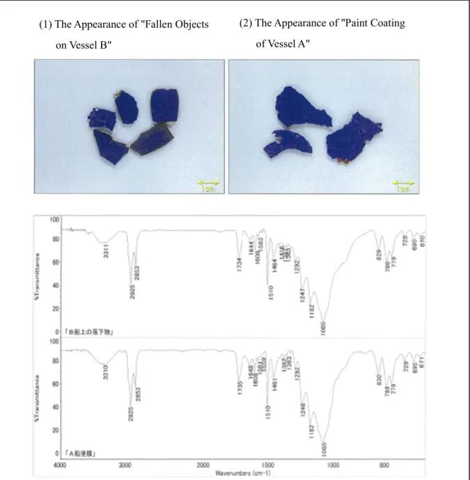
Investigations of the paint coating peelings scattered on Vessel B
As shown in Figure 17, the wavenumber range and the infrared absorption seen in the IR spectra of the.
3 ANALYSIS
Situation of the Accident Occurrence
According to 2.1, 2.8 and 3.1.1 it is probable that ship A had a bow bearing of approximately 145° and a speed of approximately 10.5 kn when it collided with ship B, which was heading towards sailed the southeast. .
Causal Factors of the Accident
① When the launch stations were effective, inside the wheelhouse of ship A, Master A was directing the maneuver while keeping a lookout on No.1 radar, officer A2 and quartermaster were responsible for the operation of the engine telegraph and steering, respectively. However, no one noticed the presence of Ship B because the marks of Ship B were hidden by the reflection of the rain clouds, and Ship B was sailing within the minimum detection distance of Ship A's radar. ② From the time Master B recognized for the first time sighted ship A while both ships were sailing parallel to each other, Master B did not continue to monitor the movements of ship A because he assumed that ship A was an incoming ship and ship B had passed to the east of ship A. which was anchored at the Pier.
Furthermore, when Vessel A navigated near Vessel B's starboard side, Vessel B's starboard view was obscured by Vessel A's port hull, so she was unaware that Vessel A was approaching. But from around At 19:18 Vessel B navigated closer to within 17 meters of the port side of Vessel A and entered the blind spot from within Vessel A's wheelhouse. ④ It is highly probable that master A and officer A1 after 19:16:38 was unable to recognize the signs of vessel B because she was navigating within the minimum detection distance of radar no.1.
⑤ It is likely that Captain B's failure to notice the approach of ship A may be due to the sound of ship B's main engine and the sound of rain at the time of the accident.
4 PROBABLE CAUSES
② Probably at about 19:07 at the northeast end of the jetty, Master B first recognized Vessel A and thought it was an incoming vessel as it appeared to be stationary. ③ Master B probably did not confirm the movement of Vessel A because he thought that Vessel A was moored at the wharf, so he directed Vessel B towards the shore of Haneda Airport and continued full ahead. ④ It is likely that Master B near the port thought that vessel B passed the moored vessel A on his starboard side.
He did not realize that vessel A was increasing her speed and approaching vessel B's starboard side, so he continued to navigate until vessel B approached vessel A's bow near the Oi Container Wharf.
5 SAFETY ACTIONS
Safety Actions Taken
Company B shared the information about the sequence of events, conditions and causes of the accident with the crew members employed by Company B. In addition, Company B also retrained their crew members regarding safe navigational precautions for navigation on large vessels based on the "Navigational Safety Instruction Manual for Construction Vessels in Tokyo Port (3 . edition)" published by the Bureau of Port and Harbor, Tokyo Metropolitan Government. Furthermore, in accordance with Section 18 of the Harbor Regulations Act, they were required to sail sufficiently far from large vessels while sailing within the harbour.
Safety Actions Required